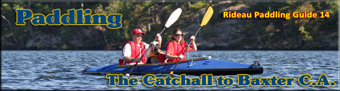
Paddling the Rideau River from The Catchall to Baxter Conservation Area
This is an easy paddling river section of the Rideau River, part of The Long Reach, a section of the Rideau Canal uninterrupted by locks. The map included in this guide can be enlarged (while viewing the PDF) to any level of detail you desire as an aid for travel planning.
You can view or download the PDF file:
| (Clicking this link will open the PDF. You can also just right mouse click the above link and use "Save Target As" to send the PDF directly to your computer.) |

Water Access
Water access in this section is available at several points. At the south end is the small ramp at the foot of Muldoon Road at 45° 01.400'N - 75° 42.400'W (on the south side of the Rideau River near Barnes Island). Near the middle are the ramps at Becketts Landing (45° 02.470'N - 75° 41.690'W), located on the north side of the river at the foot of Malakoff Road and the ramp in Rideau River Provincial Park (45° 03.440'N - 75° 40.310'W) which has a dock plus lots of parking. Further north, also on the north (more west at this point) side of the river is Reeve Craig ramp (45° 04.400'N - 75° 38.580'W) located at the foot of Greenline Road. In Kemptville (on Kemptville Creek) there is a public ramp in Curry Park (45° 01.200'N - 75° 38.475'W) located at the foot of Parliament Street. There is also Pirate Cove Marina located on the east side of the Rideau River.
Facilities
Lodging: If you're paddling and camping, the lockstations are a good choice for camp spots (a camping fee applies). In this section (no locks) a good option is the Rideau River Provincial Park. There are a few B&Bs in the general area, plus a hotel (Merrickville), motel (Kemptville) and a host of accommodations in Ottawa. For information about local accommodations see: www.ottawatourism.ca and www.rideau-info.com (this website).
Supplies: A local source for supplies is the town of Kemptville which has which full facilities (grocery stores, pharmacies, hardware stores).
Big Boats
You'll be sharing the Rideau with big power boats (cruisers). The Rideau is generally not a crowded waterway and often you'll find the large boats in "packs" - travelling from lock to lock - once they pass by you won't see any for awhile. Some of these boats can generate a large wave. The general rule for a paddler and large waves is to meet them head on, this can actually be fun in a kayak (not as much fun in a canoe).
The main navigation channel is shown on the map as a blue dashed line - this is where the big boats will be travelling. So, if you wish to avoid these, pick a route away from the navigation channel. Many paddlers prefer paddling near shore, it's more interesting (i.e. wildlife, cottages) and it keeps you farther away from the waves produced by big boats.
There are several "no wake" zones on the Rideau - these have been marked on the maps. Boaters within these areas are supposed to be travelling at a slow enough speed (less than 10 kph) that their boat doesn't generate any potentially damaging or dangerous waves.
Wind
A question often asked is which way does the wind blow? The prevailing wind, powered by the jet stream, is from the southwest. That's about the only rule of thumb. If a front is moving in then the wind can come from any direction. I've been on several paddles where I've been paddling into the wind on the way out in the morning and into the wind on the way back in the afternoon because the wind swung around 180 degrees (for some reason it never seems to work the other way around - at your back both ways). So, if you're going to travel the entire Rideau, going from Kingston to Ottawa improves the odds of having the wind at your back - but be prepared for anything.
Etiquette
Your trip planning should include a "leave no trace" approach - carry out what you carry in. Many areas are un-serviced (no garbage cans) - so plan to be self-contained. The lockstations provide waste disposal facilities.
Preparation & Safety
Please read the trip planning information on www.rideau-info.com/canal/paddling/. While these lakes are easy paddling, normal paddling preparations should be made (all required safety gear, maps, food, water, first-aid kit, etc.). Zebra mussels are present in many areas along the Rideau, so a pair of water shoes (to avoid cut feet) is recommended.
Please take all normal safety precautions, including checking the weather forecast before you head out and making sure that someone on shore knows your planned travel route and itinerary.
Navigation
While the Rideau is generally easy to navigate, taking along a set of maps is a must (in addition to any GPS you might have). Although the map in this guide is an accurate 1:50,000 representation of the waterway (when printed to 8.5" x 11"), you may also wish to also have the 1:20,000 hydrographic chart for this section (Chart 1513). For power boat navigation, the charts are an absolute must (the map in this guide should not be used for power boat navigation). The charts are also very handy for the paddler, since they show the Rideau in great detail, including depths (which can be helpful when looking for wildlife habitat or just interesting places to paddle).
The charts also show all the navigation buoys. These are all numbered (red buoys have even numbers, green buoys have odd numbers) and so can be used as an aid in locating yourself on the map when you're on open water. A subset of those buoy numbers have been included on the paddling guide maps.
For those wishing to go off the beaten path or want to know more of the topography and geographic features of the surrounding countryside, the 1:50,000 NTS maps for this section are 31B/13 and 31G/4.
Distances:
Circumference distances are approximate, following the main shorelines. The navigation channel is shown on the map.
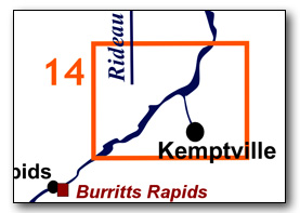
- The Catchall to Baxter Conservation Area along the navigation channel = 14.0 km (8.7 mi)
- Rideau River to Kemptville along Kemptville Creek = 5.4 km (3.4mi)
The Rideau River
The Rideau River is generally a slow moving river. There are no weirs or dams in this section. Zebra mussels are present. Aquatic vegetation growth is present in most sheltered areas with a depth of less than 10 ft (3 m).
The Catchall to Baxter C.A.
In the pre-canal era, the river was a few feet lower than it is today, water levels have been raised by the canal dam at Long Island.
This section is part of the Long Reach, the longest stretch of the Rideau Canal uninterrupted by locks. It extends 40 km / 25 mi from the Burritts Rapids Lock to the Long Island Locks. The river channel has a maximum depth of 12 ft (3.6 m). The water depth outside of the marked channel averages about 4 ft (1.2 m). The Catchall is a meander of the Rideau River that is now bypassed by a dredged canal cut. The land bordering the river is all privately owned except for the Rideau River Provincial Park, the Baxter Conservation Area and the Crown Land between County Rd. 44 and Kemptville Creek (formerly the G. Howard Ferguson Forest Station). There is modest cottage/home development, mostly along the south shore plus a fair bit of natural (farm) frontage.
A short, off the beaten path, route suggestion has been made to paddle up Kemptville Creek (see Route Suggestions below).
The Locks
Most Rideau lockstations offer facilities such as washrooms, water, recycling cans, waste cans and picnic tables. Most also allow camping for paddlers travelling the Rideau for a modest camping fee. Paddlers can portage the locks for free, but you owe it to yourself to lock through at least one lock in order to get the full experience of paddling the Rideau Canal. See www.rideau-info.com/canal/fees.html for the current fee schedule.
Points of Interest (listed south to north)
The Long Reach: this section of the canal is part of the Long Reach, the longest section of the Rideau Canal uninterrupted by locks (40 km / 25 mi). The canal dam at Long Island, the next set of locks, raised the Rideau River in that location by about 8 m (26 ft), flooding it all the way up to the foot of Burritts Rapids and making the entire section navigable (the main rapids that were flooded were those at Long Island itself).
The Catchall: : This is an original meander of the Rideau River. One interpretation of the name is that this spot would catch all the debris being carried down the river by spring flooding. The river, both pre and post canal, carried uprooted trees and other debris, depositing them where currents slowed or the river took a meander. Surveyor John Burrows, during his May 1827 survey, noted in the area between here and Burritts Rapids, that "the river here much diminished in size by quantities of flood wood on both sides."
A dredged cut was made to straighten the channel and bypass The Catchall in the mid-1900s.
Becketts Landing: This was the site of a post-canal ferry service and then later, a bridge. The ferry traversed the river at the location of marker buoy N171. The original landing was located about 200 metres west of the present day Becketts Landing Bridge.
In 1864/65, a swing bridge was built at a narrow part of the river (Fisherman's Point), some 500 metres upstream of the original landing. It had five spans, the southernmost was the swing bridge. In about 1902, the wooden spans were replaced with steel spans (the swing bridge remained wood). The bridge fell out of use when the fixed highway bridge (today's Becketts Landing Bridge) was built in 1936-37. The timber swing bridge was removed for use at Fort Henry in Kingston. The concrete bridge abutment for the original bridge can be seen on the south side of the river. On a calm day, you can look down, about 25 ft/ 8 m out from the abutment, and see the remains of a former bridge support about 10 ft / 3 m, underwater.
Becketts Landing Bridge: This fixed bridge, which carried the former Highway 16 (now Cty. Rd. 44 in this area) across the river, was built in 1936-37. It was rebuilt in 1991/92.
Rideau River Provincial Park: This 170 ha Provincial Park is located on the north shore of the Rideau River (across from the mouth of Kemptville Creek). It offers camping sites, a fitness trail, sandy beach and a boat launch. For more info see: www.ontarioparks.com/park/rideauriver
Kemptville Creek: Once known as the South Branch of the Rideau River, the name was changed to Kemptville Creek in 1908. The creek itself is 63 km long, but less than 5.5 km of paddling will take you up the creek from the Rideau River to Kemptville. Although the creek between the Rideau River and Kemptville is in a 10 kph "watch your wake" zone, be aware that the might be some speeding boats (usually fishing boats).
The creek is, in theory, navigable by canoe/kayak south to Bishops Mills (portages needed in Kemptville and in Oxford Mills) - but I've never done this section so I cannot advise on the details.
Kemptville: This area was first settled by Lyman Clothier and family. Clothier built a sawmill here in about 1815 and then added a grist mill in about 1821. Originally known as The Branch, the small community became known as Clothier's Mills. In 1828 the town was renamed Kemptville in honour of Sir James Kempt, the Governor General of British North America. Today Kemptville is a service town for the region. Much of the commercial development these days is on a strip along County Road 43.
Constable Hiram C. O'Callaghan Bridge: This is the high level bridge that carries Highway 416 across the Rideau River. Highway 416, the Veterans Memorial Highway, is a north-south highway linking Highways 401 and 417. It was built in the 1990s.
Baxter Conservation Area: This 68 ha Conservation Area features over 5 km of trails plus a sandy beach and picnic area. It is run by the Rideau Valley Conservation Authority (www.rvca.ca).
Off The Beaten Path
Kemptville Creek (11 km return)
You can paddle all the way to Kemptville by following Kemptville Creek. The west bank of the creek for the first few kilometres is the Ferguson Forest Centre. It contains several hiking trails (see: www.fergusonforestcentre.ca/visit/trails). You can get out and stretch your legs at the public dock and ramp in Curry Park.
Geology
As you paddle the Rideau Canal, the route you follow is defined by its geology. Geological highlights have been included in the Points of Interest listings and a general geological history of the route can be found on the Geology of the Rideau Page.
Wildlife Viewing
A section about wildlife viewing, what you might expect to see on your Rideau journey, has been included in text form in the PDF. A version of this information, that includes photos of some typical Rideau wildlife, can be found on the Fauna of the Rideau Page (in the ecology section of this website).
Errors
If you find any errors or omissions in this guide, please let me know (rideauken@gmail.com) and I'll get them fixed.
Terms of use
This guide may be freely used for personal purposes. Have fun on your Rideau paddling adventure.
Commercial use is not allowed in whole or in part without express written permission.
©2010- Ken W. Watson, All Rights Reserved.
You can view or download the PDF file:
| (Clicking this link will open the PDF. You can also just right mouse click the above link and use "Save Target As" to send the PDF directly to your computer.) |
|