Introduction
| |  |
| |
A Drowned Forest
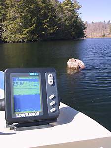
This photo shows the "stump" of a still rooted tree in over 25 feet of water. In fact it is part of a drowned forest located above the fixed bridge at Jones Falls. The remains of many other such trees lurk beneath the water in this location. Photo by Ken W. Watson, 2004.
|
Stumps still rise from the waters of the Rideau Canal, the remnants of forests that were drowned with the building of the canal. The Rideau is a slackwater system; navigation was achieved by building dams to drown waterfalls and rapids. In the pre-canal era, the Rideau was a wild place of lakes, marshes, canyons, rivers and sinuous creeks, the latter two often interrupted by rapids and waterfalls. It spanned three watersheds, those of the Rideau River, the Gananoque River and the Cataraqui River.
The building of the Rideau Canal changed this landscape dramatically; today the Rideau spans only two watersheds, pre-canal lakes have become larger and several of the creeks and rivers are now lakes or marshes. Although less than 10% of the Rideau Canal consists of man-made structures such as locks and canal cuts, most of the Rideau has been subject to some degree of flooding. To understand the geographic changes brought about by the building of the Rideau Canal, one has to answer the question “what did the Rideau look like before the canal system was built?” The answer to that question is also required to gain a full understanding and appreciation of the engineering design and human effort that went into the building of the Rideau Canal.
Acknowledgments
The concept of a project to determine the actual amount of flooding caused by the Rideau Canal, and to reconstruct the pre-flooding landscape, originated from discussions with the author and Jonathan Moore, Marine Archaeologist, Underwater Services Branch, Parks Canada Agency. That project, conducted on a volunteer basis by the author, could not have been done without access to the extensive image collection of archival maps assembled for the Rideau Canal Submerged Cultural Resource Inventory, which Jonathan freely provided. Jonathan was also instrumental in assisting with the acquisition of additional archival material and in making many excellent constructive suggestions on the initial draft of the research document. The results of that project were detailed in the research document, “Engineered Landscapes: The Rideau Canal’s Transformation of a Wilderness Waterway” published in 2006, from which the general audience book “The Rideau Route,” published in 2007, was derived.
|